Archivo:World98.svg

Ver la imagen en su resolución original ((Imagen SVG, nominalmente 8000 × 3859 pixels, tamaño de archivo: 9,3 MB))

NOTE!
This file is HUGE. It cannot open in inkscape with 2GB of memory, or probably with 4GB either (however, gimp or a similar program should be able to generate a thumbnail without keeping the whole image in core). In other words, you will most likely be unable to open this on a 32-bit computer. It is only intended for use by other wiki map geeks to generate smaller SVG maps of countries and regions. Also note that, whenever possible it is better to use one of the continental maps that came from the same source, as they are more usable (won't eat all your system memory) and more precise (16 digits instead of 12):
- Image:africa98.svg
- Image:asia98.svg
- Image:europe98.svg
- Image:south_america98.svg
- Image:oceania98.svg
- Image:north_america98.svg
Resumen
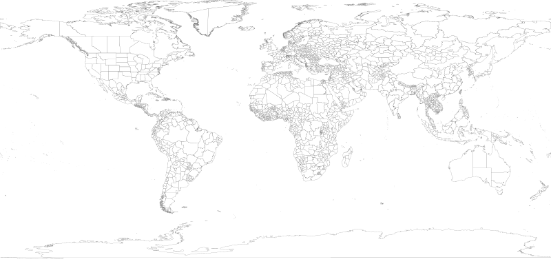
| Descripción | 1998 World map with first level administrative units. |
| Fecha | |
| Fuente | world98.shp from the US CDC [1] |
| Autor | Translated to SVG by User:Brianski |
| Otras versiones |
|
| SVG desarrollo | El código fuente de esta imagen SVG de gran tamaño es válido. Este mapa de gran tamaño fue creado con una desconocida SVG herramienta |

TODO
- Find the right projection for and generate an antarctica98.svg
- Some submaps that don't follow continental boundaries might be handy, e.g. carribean98.svg, middle_east98.svg, mediterranean98.svg, se_asia_and_australia98.svg, etc.
- Fix blips in USA (Utah, PA, Michigan, etc.), west Antarctica. change background color so these blips are more obvious and thus easier to fix.
- Also group properly. IE: There shouldn't be >50 seperate USA groups for each state/territory, instead they should be nested together in a common USA group.
- Make copies of this map with country borders shown in darker lines.
- The territory of Nunavut was formed in 1999, giving Canada three territories in the north - not the 2 displayed here.
Generation Notes
perl xml2svg.pl -P12 --proj=cylindrical_equidistant:0,0.793353340291235 -x8000 world98
Licencia
Esta imagen es una obra de los Centros para el Control y la Prevención de Enfermedades, parte de los Departamento de Salud y Servicios Humanos de los Estados Unidos, adoptadas o realizados durante el desempeño de funciones oficiales de un empleado. Como una obra de los Estados Unidos del gobierno federal, la imagen es de dominio público.
|
Historial del archivo
Haz clic sobre una fecha y hora para ver el archivo tal como apareció en ese momento.
| Fecha y hora | Miniatura | Dimensiones | Usuario | Comentario | |
|---|---|---|---|---|---|
| actual | 17:18 28 jun 2018 | | 8000 × 3859 (9,3 MB) | JoKalliauer | fixed 2735 W3C-erros (now valid); removed Category:SVG files with multiple W3C-errors |
| 05:45 21 oct 2007 |  | 8000 × 3859 (18,89 MB) | Brianski | fix greenland bug | |
| 04:35 21 oct 2007 |  | 8000 × 3859 (18,89 MB) | Brianski | use 8000 width (instead of 800) so that borders aren't so huge | |
| 04:16 21 oct 2007 |  | 512 × 247 (18,89 MB) | Brianski | Switch to equidistant cylindrical projection @37.5 degrees (aka first miller equidistant cylindrical projection - http://mathworld.wolfram.com/MillerEquidistantProjection.html) | |
| 03:25 21 oct 2007 |  | 512 × 499 (18,89 MB) | Brianski | {{Information |Description=1998 World map with first level administrative units. |Source=world98.shp from the en:CDC [http://www.cdc.gov/epiinfo/documents/shapes.doc] |Date=2007/10/20 |Author=Translated to SVG by User:Brianski }} |
Usos del archivo
No hay páginas que enlacen a este archivo.
Uso global del archivo
Las wikis siguientes utilizan este archivo:
- Uso en en.wikipedia.org
- Uso en uk.wikipedia.org
- Uso en zh.wikipedia.org