Archivo:The Ship Keyingham.jpg
The_Ship_Keyingham.jpg (640 × 474 píxeles; tamaño de archivo: 81 kB; tipo MIME: image/jpeg)
Resumen
| Descripción |
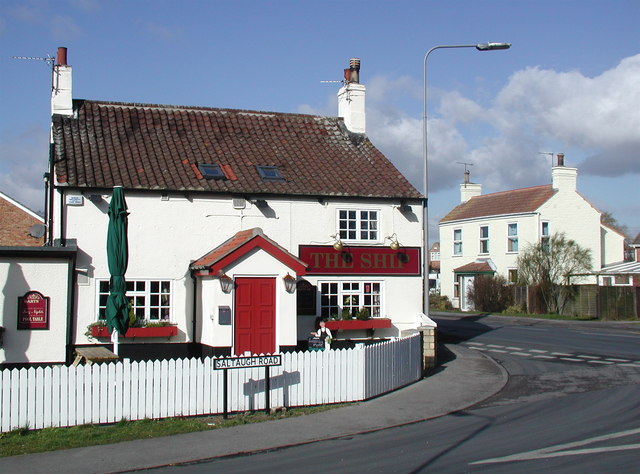
English: The Ship, Keyingham, East Riding of Yorkshire, England. This unassumingly named pub on the corner of Saltaugh Road and Main Street gets its title from one fleeting moment when the village of Keyingham was of some interest to historians.
|
| Fecha | |
| Fuente | From geograph.org.uk |
| Autor | Paul Glazzard |
| Permiso (Reutilización de este archivo) |
Creative Commons Attribution Share-alike license 2.0 |
| Atribución (requerido por la licencia) | Paul Glazzard / The Ship, Keyingham / |
| Posición de la cámara | | Ubicación de esta y otras imágenes en: OpenStreetMap |
|---|
Licencia

|
Esta imagen proviene de la colección del proyecto Geograph British Isles. Veáse la página de esta fotografía en el sitio web de Geograph para más información del fotógrafo. El titular de los derechos de autor de esta imagen es Paul Glazzard y autoriza utilizarla bajo la licencia Reconocimiento-CompartirIgual 2.0 de Creative Commons.
|
- Eres libre:
- de compartir – de copiar, distribuir y transmitir el trabajo
- de remezclar – de adaptar el trabajo
- Bajo las siguientes condiciones:
- atribución – Debes otorgar el crédito correspondiente, proporcionar un enlace a la licencia e indicar si realizaste algún cambio. Puedes hacerlo de cualquier manera razonable pero no de manera que sugiera que el licenciante te respalda a ti o al uso que hagas del trabajo.
- compartir igual – En caso de mezclar, transformar o modificar este trabajo, deberás distribuir el trabajo resultante bajo la misma licencia o una compatible como el original.
Historial del archivo
Haz clic sobre una fecha y hora para ver el archivo tal como apareció en ese momento.
| Fecha y hora | Miniatura | Dimensiones | Usuario | Comentario | |
|---|---|---|---|---|---|
| actual | 19:35 10 feb 2010 | | 640 × 474 (81 kB) | Keith D | == {{int:filedesc}} == {{Information |Description={{en|1=The Ship, Keyingham, East Riding of Yorkshire.<br />This unassumingly named pub on the corner of Saltaugh Road and Main Street gets its title from |
Usos del archivo
La siguiente página usa este archivo:
Uso global del archivo
Las wikis siguientes utilizan este archivo:
- Uso en ang.wikipedia.org
- Uso en ceb.wikipedia.org
- Uso en en.wikipedia.org
- Uso en fr.wikipedia.org
- Uso en lld.wikipedia.org
- Uso en pl.wikipedia.org
- Uso en sv.wikipedia.org
- Uso en www.wikidata.org