Archivo:Newbold, Leicestershire - geograph.org.uk - 373338.jpg
No se dispone de una resolución más alta.
Newbold,_Leicestershire_-_geograph.org.uk_-_373338.jpg (640 × 427 píxeles; tamaño de archivo: 98 kB; tipo MIME: image/jpeg)
Resumen
| Descripción |
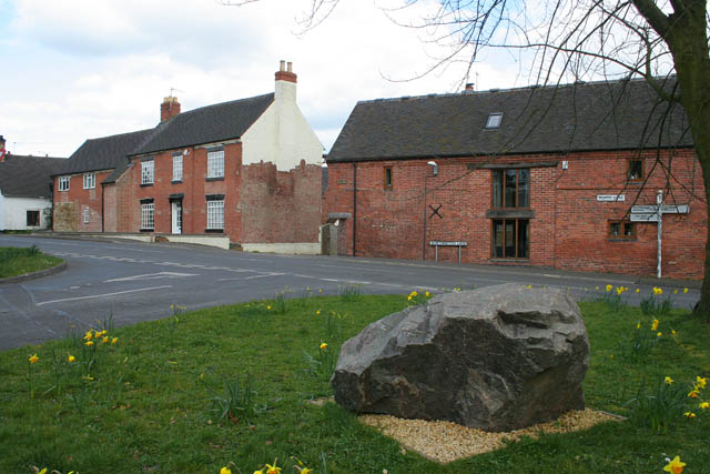
English: Newbold, Leicestershire This road junction is just inside the featured square according to the 1:25,000 OS map. The main village street is Worthington Lane to the left and School Lane to the right. The street joining at the junction is Ashby Road. The large boulder is of the local stone; there are numerous quarries in the area, both working and disused, the nearest being at Cloud Hill in SK4121. |
| Fecha | |
| Fuente | From geograph.org.uk |
| Autor | Kate Jewell |
| Atribución (requerido por la licencia) | Kate Jewell / Newbold, Leicestershire / |
| Posición de la cámara | | Ubicación de esta y otras imágenes en: OpenStreetMap |
|---|
_heading:67.00&language=es)
| Ubicación del objeto | | Ubicación de esta y otras imágenes en: OpenStreetMap |
|---|
_heading:67.00&language=es)
Licencia

|
Esta imagen proviene de la colección del proyecto Geograph British Isles. Veáse la página de esta fotografía en el sitio web de Geograph para más información del fotógrafo. El titular de los derechos de autor de esta imagen es Kate Jewell y autoriza utilizarla bajo la licencia Reconocimiento-CompartirIgual 2.0 de Creative Commons.
|
Este archivo se encuentra bajo la licencia Creative Commons Genérica de Atribución/Compartir-Igual 2.0.
Atribución: Kate Jewell
- Eres libre:
- de compartir – de copiar, distribuir y transmitir el trabajo
- de remezclar – de adaptar el trabajo
- Bajo las siguientes condiciones:
- atribución – Debes otorgar el crédito correspondiente, proporcionar un enlace a la licencia e indicar si realizaste algún cambio. Puedes hacerlo de cualquier manera razonable pero no de manera que sugiera que el licenciante te respalda a ti o al uso que hagas del trabajo.
- compartir igual – En caso de mezclar, transformar o modificar este trabajo, deberás distribuir el trabajo resultante bajo la misma licencia o una compatible como el original.
- Remove redundant categories and try to put this image in the most specific category/categories
- Remove this template
- The location categories are based on information from this geonames tool and this OpenStreetMap tool combined with a database. You can also have a look at this tool from mysociety.
- The topic category from Geograph was Village street (find similar images street at Geograph)
Historial del archivo
Haz clic sobre una fecha y hora para ver el archivo tal como apareció en ese momento.
| Fecha y hora | Miniatura | Dimensiones | Usuario | Comentario | |
|---|---|---|---|---|---|
| actual | 21:06 4 ene 2011 | | 640 × 427 (98 kB) | GeographBot | == {{int:filedesc}} == {{Information |description={{en|1=Newbold, Leicestershire This road junction is just inside the featured square according to the 1:25,000 OS map. The main village street is Worthington Lane to the left and School Lane to the right. |
Usos del archivo
La siguiente página usa este archivo:
Uso global del archivo
Las wikis siguientes utilizan este archivo:
- Uso en en.wikipedia.org
- Uso en pl.wikipedia.org
- Uso en www.wikidata.org