Archivo:Map of Knickebein transmitters.svg

Tamaño de esta previsualización PNG del archivo SVG: 527 × 599 píxeles. Otras resoluciones: 211 × 240 píxeles · 422 × 480 píxeles · 676 × 768 píxeles · 901 × 1024 píxeles · 1802 × 2048 píxeles · 658 × 748 píxeles.
Ver la imagen en su resolución original ((Imagen SVG, nominalmente 658 × 748 pixels, tamaño de archivo: 112 kB))
Resumen
| Descripción |
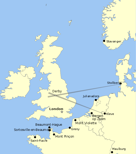
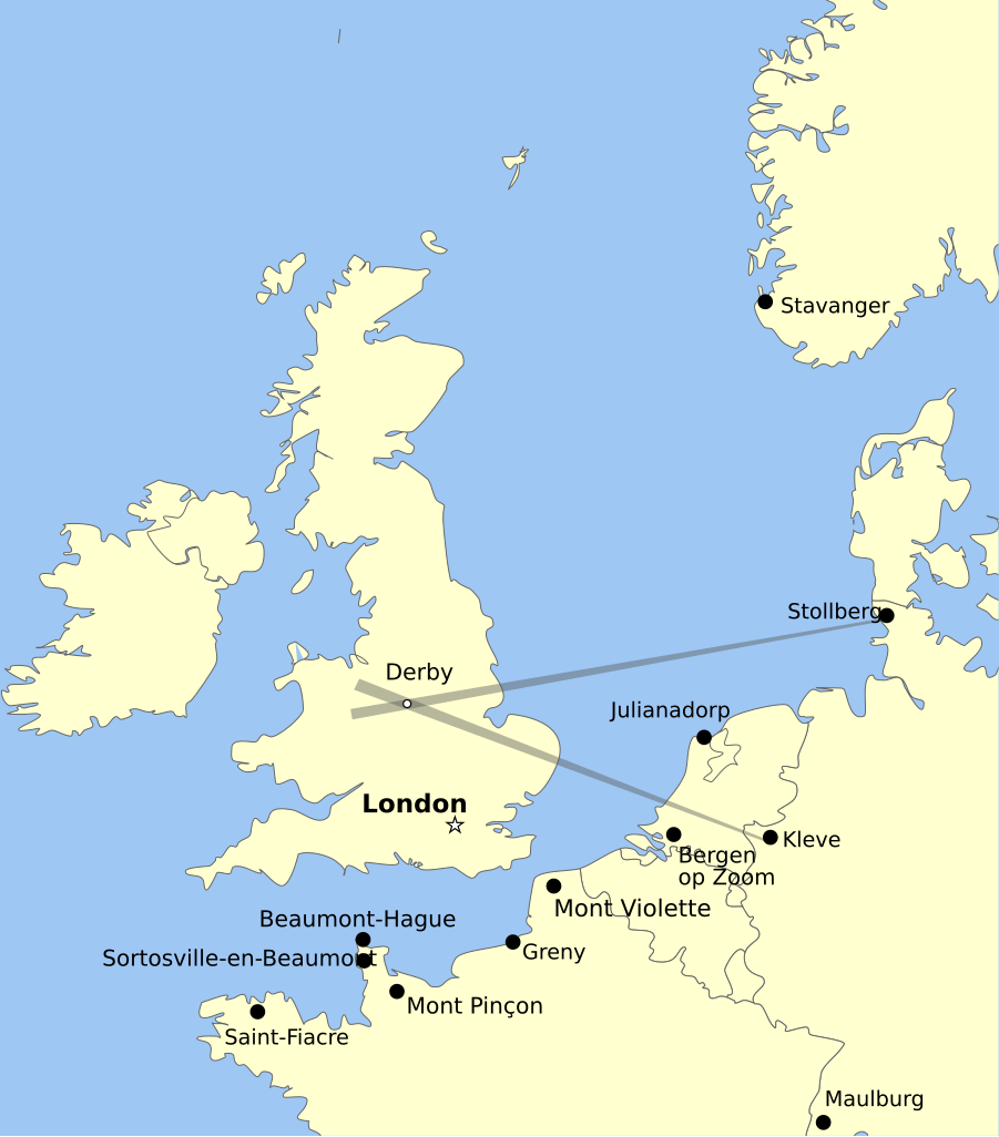
English: Map showing the positions of Knickebein transmitters during the battle of Britain. |
| Fecha | |
| Fuente | Trabajo propio |
| Autor | Dahnielson |
Licencia
Yo, titular de los derechos de autor de esta obra, la publico en los términos de las siguientes licencias:
Este archivo se encuentra bajo la licencia Creative Commons Genérica de Atribución/Compartir-Igual 3.0.
- Eres libre:
- de compartir – de copiar, distribuir y transmitir el trabajo
- de remezclar – de adaptar el trabajo
- Bajo las siguientes condiciones:
- atribución – Debes otorgar el crédito correspondiente, proporcionar un enlace a la licencia e indicar si realizaste algún cambio. Puedes hacerlo de cualquier manera razonable pero no de manera que sugiera que el licenciante te respalda a ti o al uso que hagas del trabajo.
- compartir igual – En caso de mezclar, transformar o modificar este trabajo, deberás distribuir el trabajo resultante bajo la misma licencia o una compatible como el original.

|
Se autoriza la copia, distribución y modificación de este documento bajo los términos de la licencia de documentación libre GNU, versión 1.2 o cualquier otra que posteriormente publique la Fundación para el Software Libre; sin secciones invariables, textos de portada, ni textos de contraportada. Se incluye una copia de la dicha licencia en la sección titulada Licencia de Documentación Libre GNU. |
Puedes usar la licencia que prefieras.
Historial del archivo
Haz clic sobre una fecha y hora para ver el archivo tal como apareció en ese momento.
| Fecha y hora | Miniatura | Dimensiones | Usuario | Comentario | |
|---|---|---|---|---|---|
| actual | 06:47 26 ago 2011 | | 658 × 748 (112 kB) | Chriusha | Position of K 11 corrected, see Disk |
| 15:38 13 may 2011 |  | 658 × 748 (112 kB) | Hohum | More readable text. | |
| 22:18 21 abr 2010 |  | 658 × 748 (113 kB) | Dahnielson | Made the beams nicer, changed the Stollberg label and hopefully fixed the font rendering. Category:Radio navigation Category:Battle of Britain | |
| 22:14 20 abr 2010 |  | 658 × 748 (114 kB) | Dahnielson | Added Julianadorp and Bergen op Zoom to map | |
| 21:50 20 abr 2010 |  | 658 × 748 (111 kB) | Dahnielson | Added transmitter locations and the Kleve/Stollberg beams targeting Derby as an example. | |
| 19:19 20 abr 2010 |  | 658 × 748 (103 kB) | Dahnielson | Reverted to version as of 18:47, 20 April 2010 | |
| 19:18 20 abr 2010 |  | 658 × 748 (103 kB) | Dahnielson | Try to fix the font issue. | |
| 18:47 20 abr 2010 |  | 658 × 748 (103 kB) | Dahnielson | {{Information |Description={{en|1=Map showing the positions of Knickebein transmitters during the battle of Britain.}} |Source={{own}} |Author=Dahnielson |Date=2010-04-20 |Permission= |other_versions= }} |
Usos del archivo
La siguiente página usa este archivo:
Uso global del archivo
Las wikis siguientes utilizan este archivo:
- Uso en ar.wikipedia.org
- Uso en de.wikipedia.org
- Uso en en.wikipedia.org
- Uso en fr.wikipedia.org
- Uso en he.wikipedia.org
- Uso en sk.wikipedia.org