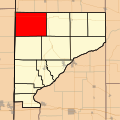
Archivo:Map highlighting Prairie Township, Warren County, Indiana.svg

Tamaño de esta previsualización PNG del archivo SVG: 512 × 512 píxeles. Otras resoluciones: 240 × 240 píxeles · 480 × 480 píxeles · 768 × 768 píxeles · 1024 × 1024 píxeles · 2048 × 2048 píxeles.
Ver la imagen en su resolución original ((Imagen SVG, nominalmente 512 × 512 pixels, tamaño de archivo: 115 kB))
Historial del archivo
Haz clic sobre una fecha y hora para ver el archivo tal como apareció en ese momento.
| Fecha y hora | Miniatura | Dimensiones | Usuario | Comentario | |
|---|---|---|---|---|---|
| actual | 18:06 3 ene 2016 |  | 512 × 512 (115 kB) | Omnedon | State map inset |
| 04:21 27 ene 2008 |  | 512 × 512 (41 kB) | File Upload Bot (Omnedon) | == Summary == {{Information |Description={{en|This is a map of Warren County, Indiana, USA which highlights the location of Prairie Township.}} |Source=My own work, using freely-available TIGER data and custom-written MapScript applications |Date=2008-01 | |
| 19:28 24 nov 2007 |  | 512 × 512 (36 kB) | File Upload Bot (Omnedon) | == Summary == {{Information |Description={{en|This is a map of Warren County, Indiana, USA which highlights the location of Prairie Township.}} |Source=My own work, using freely-available TIGER data and custom-written MapScript applications |Date=2007-11 |
Usos del archivo
La siguiente página usa este archivo:
Uso global del archivo
Las wikis siguientes utilizan este archivo:
- Uso en en.wikipedia.org
- Uso en eu.wikipedia.org
- Uso en ur.wikipedia.org
- Uso en vi.wikipedia.org
- Uso en www.wikidata.org
- Uso en zh.wikipedia.org