Archivo:Iyo-Aoshima Island Aerial photograph.jpg
Tamaño de esta previsualización: 800 × 580 píxeles. Otras resoluciones: 320 × 232 píxeles · 640 × 464 píxeles · 1024 × 743 píxeles · 1280 × 929 píxeles · 2531 × 1836 píxeles.
Ver la imagen en su resolución original (2531 × 1836 píxeles; tamaño de archivo: 1,09 MB; tipo MIME: image/jpeg)
Resumen
| Descripción |
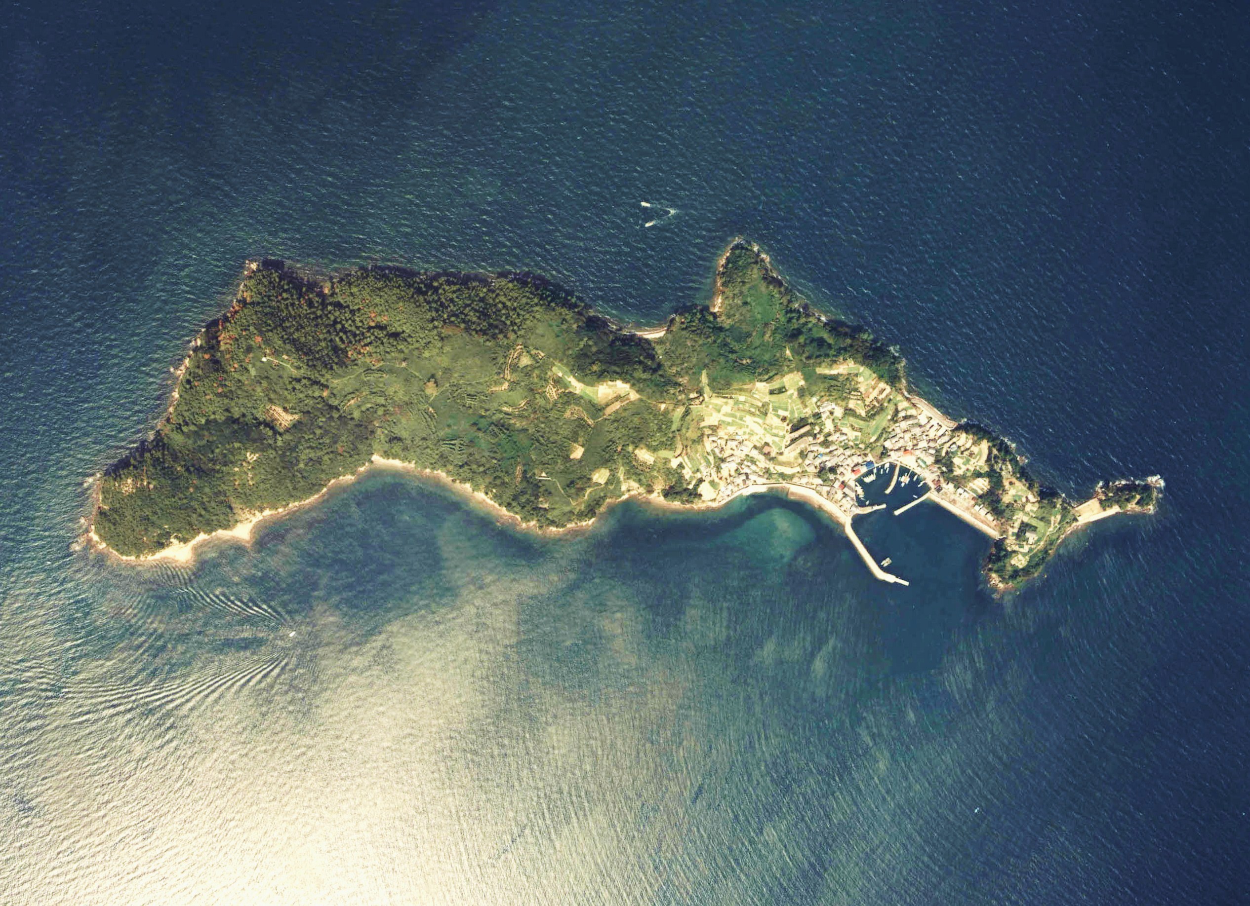
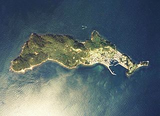
English: Iyo-Aoshima Island Aerial photograph
日本語: 伊予青島付近の空中写真(愛媛県大洲市)。ccg-81-3_c48_2を利用。 |
| Fecha | |
| Fuente | 国土情報ウェブマッピングシステム |
| Autor | 国土交通省 |
Licencia

|
El propietario de los derechos de autor de este archivo, the Ministry of Land, Infrastructure, Transport and Tourism of Japan, autoriza a cualquier persona a usarlo para cualquier propósito, siempre que el titular de los derechos de autor sea atribuido apropiadamente. La redistribución, la realización de trabajos derivados, el uso comercial y otro tipo de usos están permitidos. |
Atribución:
Copyright © National Land Image Information (Color Aerial Photographs), Ministry of Land, Infrastructure, Transport and Tourism
|
 |
This image is copyrighted by the Ministry of Land, Infrastructure, Transport and Tourism of Japan. For terms of use, see the stipulation to use of National Land Information (in Japanese) and message from MLIT (in Japanese and English). When you display this image on an article, include the following phrase in the description: "Made based on National Land Image Information (Color Aerial Photographs), Ministry of Land, Infrastructure, Transport and Tourism".
|
Historial del archivo
Haz clic sobre una fecha y hora para ver el archivo tal como apareció en ese momento.
| Fecha y hora | Miniatura | Dimensiones | Usuario | Comentario | |
|---|---|---|---|---|---|
| actual | 06:43 12 nov 2012 | | 2531 × 1836 (1,09 MB) | さかおり | {{Information |Description ={{en|1=Iyo-Aoshima Island Aerial photograph}} {{ja|1=伊予青島付近の空中写真(愛媛県大洲市)。ccg-81-3_c48_2を利用。}} |Source =国土情報ウェブマッピングシステム |Author ... |
Usos del archivo
La siguiente página usa este archivo:
Uso global del archivo
Las wikis siguientes utilizan este archivo:
- Uso en az.wikipedia.org
- Uso en ca.wikipedia.org
- Uso en cs.wikipedia.org
- Uso en de.wikipedia.org
- Uso en en.wikipedia.org
- Uso en et.wikipedia.org
- Uso en fr.wikipedia.org
- Uso en id.wikipedia.org
- Uso en it.wikipedia.org
- Uso en ja.wikipedia.org
- Uso en ko.wikipedia.org
- Uso en pt.wikipedia.org
- Uso en ru.wikipedia.org
- Uso en sv.wikipedia.org
- Uso en tr.wikipedia.org
- Uso en vi.wikipedia.org
- Uso en www.wikidata.org